Groundwater specialists

spacerT: +1 (609) 947-1703

F: +1 (609) 935-0631


INTERNATIONAL CASE STUDIES - afghanistan

CASE STUDIES: AFGHANISTAN


AFGHANISTAN

CLIENT:

Canadian International Development Agengy (CIDA)

PROJECT:

Evaluation of Arghandab Irrigation Rehabilitation Project (AIRP)

LOCATION:

Kandahar Province Afghanistan (2013-2014)


Afghanistan map
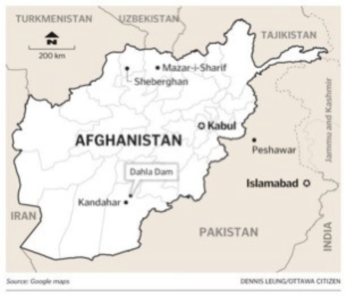
This 2014 "End-of-Project Evaluation" was conducted by UHL & Associates, Inc. in association with the Afghan firm of Silkroad Caravan to examine the relevance, efficiency, effectiveness, and sustainability of one of Canada's signature projects in Afghanistan, the Arghandab Irrigation Rehabilitation Project (AIRP or Dahla Dam Project), which was completed in March 2012. CIDA committed ~ $50 million towards the implementation of Phase 1.

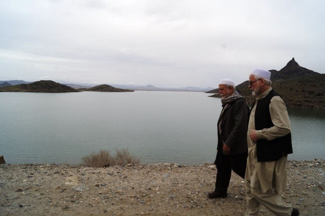
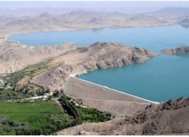
The Dahla Dam was constructed by the U.S. government in the early 1950's and has been an important factor in the economy of Kandahar Province for 6 decades. In 2008, a Technical Assistance Mission (TAM) led by Agriculture and Agri-Food Canada (on behalf of the Canadian International Development Agency (CIDA)) undertook a technical appraisal of the Dahla Dam and its downstream irrigation system. The Technical Assistance Mission Report noted two major problems with the system:

1. The Dahla Dam had silted up over time and had lost approximately 30% of its original capacity, and

2. The downstream irrigation system was in a state of disrepair, resulting in the loss of approximately 70% of the water that flowed through it due to evaporation, seepage and other inefficiencies.

Work under the AIRP was implemented by a Canadian engineering firm from 2009 to 2012 with the objectives to:

1. Rehabilitate the Arghandab irrigation system main canals, secondary canals, and water control structures as well as limited work components at the Dahla Dam site;

2. Build irrigation water management capacities within the province and at the national level; and

3. Build the capacity of the local farmers at the community level (Mirabs) in on-farm water control and management, and the introduction of alternative crops.

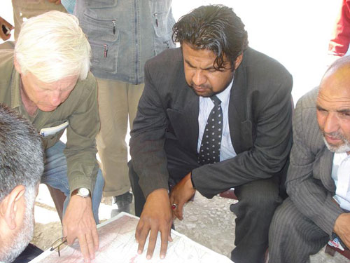
For the 2014 "End of Project Evaluation" by UHL & Silkroad Caravan, a Data Collection Program was developed which set forth the Field Mission elements, the Questionnaires used in the FM, and the data collection and planning schedule. The principal Field Mission elements from February through April 2014 included:

1. Farmer Family interviews.

2. Individual interviews with the Arghandab Sub Basin Authority (ASBA) key persons and line staff, Department of Agriculture, Irrigation, and Livestock officials (DAIL), District Governors, Tarnak Research farm persons, heads of Farmer's Associations in each district, as well as the Deputy Chancellor and the Head of the Science Department at Kandahar University.

3. Focus group discussions in each of the 3 districts in the irrigation command area.

4. Canal Infrastructure Surveys and hydrologic and agricultural data collection and analysis.


CLIENT:

Canadian International Development Agengy (CIDA)

PROJECT:

Evaluation of Arghandab Irrigation Rehabilitation Project (AIRP)

LOCATION:

Kandahar Province Afghanistan (2013-2014)
 

The Evaluation Indicated:

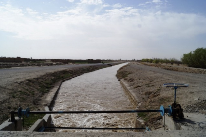
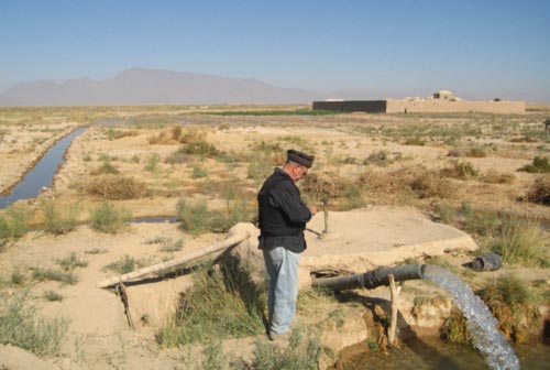
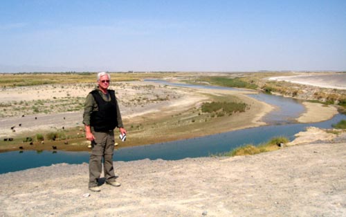
The Main Canal Infrastructure was in good condition 2+ years after the rehabilitation work had been completed. The Main Canal Flows, 1.7 km down gradient of the Diversion Weir, were measured and found to be close to the original design flows (38 m3/s v. 41 m3/s). The lack of a maintenance budget from MEW and DAIL is a major concern does not speak well for sustainability.

ASBA's stature and position in the three Districts has increased as a result of the AIRP intervention. The Agency has good leadership and engineering talent and is in a good position to provide and assist with irrigation management. ASBA has 6 technical staff for canal management and 4 for canal maintenance.

The Farmer's Responses were the most positive in Daman District where Farmers were probably seeing significant canal flows after many years as a result of the AIRP infrastructure improvements. The farmers' responses with respect to increases in crop production, income, cropping diversity, and marketed crops showed a very similar trend with the Daman District Farmers being the most positive in their responses.

Involvement of primary stakeholders such as WUAs, FAs and Mirabs: No Water User Associations were evident  from interviews and discussions with ASBA technical staff, local government officials, and local farmers. The same was the case for Farmer's Associations. The Mirab system of water management is in place and the 40+ active Mirabs control the turnout gates and are interactive with the Senior Mirab and ASBA technical staff.


BACK TO TOP


CLIENT:

USAID and Development Alternatives Inc. (DAI)

PROJECT:

Country Wide Groundwater Assessment

LOCATION:

Afghanistan


afghan mapIn early 2003, UHL was retained by DAI to develop an overall assessment of groundwater conditions in Afghanistan at large and to assess potential river basins where groundwater might be in a state of overdevelopment. Vincent Uhl traveled to several river basins and interviewed/met with relevant governmental departments and NGOs and United Nations organizations.

UHL developed an analysis of recharge to the principal aquifer systems in the 5 major river basins and developed the scope for elements of an in-depth analysis of river basins where overdevelopment of groundwater is a concern. A technical scope was also developed for river basins where groundwater is under-utilized and represents a potential source for future irrigation use.

Download PDF of The Project Report

BACK TO TOP


CLIENT:

USAID, Chemonics, and Basic Afghanistan Services (BAS), and USAID

PROJECT:

Groundwater Assessment for Irrigation Potential

LOCATION:

Khulm District, Northern Afghanistan


UHL & Associates, Inc. provided technical assistance to CHEMONICS in conducting a survey of a 300 square kilo- meter area to evaluate the potential for utilizing groundwater for crop irrigation. Over 60 open wells and drilled wells were inventoried and evaluated for yield and water quality conditions.

The elements of a comprehensive Phase 2 drilling exploration program were developed for CHEMONICS and implemented. A comprehensive exploration test well program was implemented and aquifer pumping tests were run on several wells to establish aquifer hydraulic characteristics and sustainability. Water quality was examined for irrigation suitability and a groundwater recharge analysis completed for a large project area in Northern Afghanistan. The Firm provided technical assistance in project development, design, data analysis, and reporting.


Vince Uhl in Afghanistan

Vince Uhl working in Afghanistan


  Vince Uhl working in Afghanistan

BACK TO TOP


CLIENT:

USAID and Louis Berger Group, Inc.

PROJECT:

Village Water Supply Assessment

LOCATION:

Gilan District, Ghazni Province, South-Eastern Afghanistan


In 2003, the Louis Berger Group retained UHL to evaluate the drinking and irrigation water-supply situation in 14 villages in Gilan District of Ghazni Province. These villages were experiencing water supply shortages. UHL coordinated this work with our local partner, Basic Afghanistan Services (BAS), an Afghan NGO specializing in water development and civil engineering.

The principal project objectives were to assess the adequacy of the current water-supply sources (drinking and irrigation) for each village in terms of quantity, quality, and reliability; and inventory the water sources in each village.

Sixty-two (62) karezes; 86 hand-dug wells; and 4 drilled wells were identified in the survey. Traditionally karezes and hand-dug open wells have provided irrigation and drinking water to the 13 villages. The field program documented that many of the karezes and shallow dug wells had gone dry or diminished in yield due to lowering of the water table during an extended four year drought. In the case of the karezes, these water-supply systems are sensitive to long-term droughts as they are essentially skimming water from the top of the saturated zone (water table) and water levels can fall below the bottom of the intake or mother wells during a sustained period of drought.

Similarly, the hand-dug open wells are generally constructed a few meters below the top of the water table and likewise their yields reduce or diminish entirely in a long-term drought.

For villages lacking access to adequate clean drinking water and reduced sources of irrigation water, alternatives were developed to improve water-supply conditions. The technical elements and projected costs were developed for an implementation phase involving new water-supply sources or existing source improvements.

desert zones

Figure 3: Cross-section of a Karez
(Source: "The Warm Desert Environment" by Andrew Goudie and John Wilkinson, 1977)

BACK TO TOP


CLIENT:

USAID and Associates in Rural Development (ARD) and USAID

PROJECT:

Groundwater Assessment for Irrigation Potential

LOCATION:

Bakwa District, Farah Province, Southwest Afghanistan

Afghan Farah River Map

Satellite Image Depicting Alluvial Fans
Click to see larger image

UHL & Associates and Basic Afghanistan Services (BAS) evaluated groundwater development potential in Bakwa District and portions of Farah District in Farah Province southwestern Afghanistan. The project was carried out and completed in 2009/2010 under the USAID ADP/SW project. The Study was focused on assessing groundwater resource development potential and constraints for irrigation use in Bakwa District and along reaches of the Farah River in Farah District. The central and southern part of Bakwa District is characterized by productive loess soils that are farmed for wheat and other crops.


The central and southern part of Bakwa District is characterized by productive loess soils that are farmed for wheat and other crops. The Study concluded that there is one principal aquifer unit (conglomerate and sandstone aquifer) in the central and southern parts of Bakwa District that is regional in extent, around 30 meters thick, and with considerable groundwater storage capacity. Well yields from less that 20 lps up to 70 lps have been documented. The aquifer system receives healthy recharge and comprises a renewable resource. Recharge is principally from the infiltration of seasonal surface-water runoff from a number of stream drainages and river systems that head in the mountainous areas to the north, northeast and east of the farmed areas. There are large alluvial fans (some > 100 km2) that are prime groundwater recharge areas.

The conglomerate and sandstone aquifer contains very fresh water (low total dissolved solids or TDS content) in the plain areas in the north, northeast and east District areas. TDS levels show an increase in concentration from these groundwater recharge areas (alluvial fans) to the west-southwest.

The Study confirmed that there are opportunities for irrigation in the District as well as the need for the demonstration of new irrigation technologies and best practices. Technical input and guidance to improve irrigation application efficiency will reduce water usage, allow more hectares to be irrigated and reduce pumping costs. This can be accomplished through demonstration plots on existing farms, and/or new farm developments with improved irrigation techniques and other innovations.

Afghanistan irrigation well

Inventory of an Irrigation Well and Field Testing of Water Quality

Afghanistan Farah River

Vince Uhl near the Farah River


Download PDF of the USAID Report

BACK TO TOP

 
CASE STUDIES: AFRICA, MIDDLE EAST, CARIBBEAN, GLOBAL
CONTACT US
  SITE MAP  
  © 2015 All materials the property of UHL & Associates, Inc.