INTERNATIONAL CASE STUDIES - AFRICA
CASE STUDIES: BOTSWANA, CAMEROON, ETHIOPIA, LIBERIA, MALAWI, NIGER, SENEGAL, SOMALILAND, VARIOUS COUNTRIES
| BOTSWANA |
CLIENT: |
Department of Water Affairs, Republic of Botswana |
|
PROJECT: |
Maun Groundwater Development Project
Phase 1: Exploration and Resource Assessment |
|
LOCATION: |
Maun, Botswana
|
|
 The joint venture of Uhl & Associates and Water Resource Consultants (Pty) Ltd. (WRC) was contracted by the Department of Water Affairs, Government of Botswana to conduct a groundwater resource assessment and development feasibility study for a 5,000 square mile area in northwest Botswana with the objective of securing a safe sustainable source for the town of Maun to the year 2030. The study area is on the fringes of the Okavango Delta, one of the largest inland deltas in the world. The study was initiated after a major dam project proposed by Snowy Mountain Engineering Corp (SMEC) of Australia on behalf of the government was terminated after a critical review by the IUCN (International Union for the Conservation of Nature). The study area is primarily in and on the fringes of the Kalahari Desert. Prior to the study, freshwater resources were thought to be very limited and confined to near perennial and seasonal water courses. The joint venture of Uhl & Associates and Water Resource Consultants (Pty) Ltd. (WRC) was contracted by the Department of Water Affairs, Government of Botswana to conduct a groundwater resource assessment and development feasibility study for a 5,000 square mile area in northwest Botswana with the objective of securing a safe sustainable source for the town of Maun to the year 2030. The study area is on the fringes of the Okavango Delta, one of the largest inland deltas in the world. The study was initiated after a major dam project proposed by Snowy Mountain Engineering Corp (SMEC) of Australia on behalf of the government was terminated after a critical review by the IUCN (International Union for the Conservation of Nature). The study area is primarily in and on the fringes of the Kalahari Desert. Prior to the study, freshwater resources were thought to be very limited and confined to near perennial and seasonal water courses.
UHL and WRC headed the project team which was comprised of 30 technical experts, including professors at the University of Botswana in the fields of remote sensing, vegetation analysis, geomorphology, structural geology, surface water hydrology, hydrogeochemistry, isotope studies, geophysics, hydrogeology, geology, artificial recharge, economics, cost engineering and ecology.
The project resulted in the identification of several new aquifer sources that can be utilized for water supply to Maun and the region well into the 21st century.
Principal Technical Activities:
- Groundwater exploration using airborne geophysics (magnetic and electromagnetic); satellite imagery interpretation and surface geophysical studies to identify areas for field drilling exploration.
- Groundwater resource investigation through the installation of 50 test wells. Aquifer pumping tests were run on 46 wells. Two deep bedrock test wells were installed to depths of 1,000 and 247 meters to evaluate groundwater development potential and water quality conditions in deeper bedrock aquifer systems.
- Groundwater development feasibility and sustainability analysis through aquifer modeling; recharge analysis; and groundwater-surface water interaction study.
- Supplementary project activities included: artificial recharge feasibility studies; groundwater modeling; isotope studies and seismic monitoring.
Download PDF of the Phase 1 Executive Summary
BACK TO TOP |
|
|
CLIENT: |
Water Resources Consultants (Pty) Ltd. & Department of Water Affairs
Republic of Botswana |
|
PROJECT: |
Maun Groundwater Development Project
Phase 2: Resource Assessment and Wellfield Development |
|
LOCATION: |
Maun,
Botswana |
|
 Uhl & Associates was retained by Water Resources Consultants (Pty) Ltd. from 2001 to 2004 to assist in the Phase 2 Maun Groundwater Development Project. This Project Phase involved the siting and installation of two production wellfields to provide water to the town of Maun and surroundings. UHL provided technical expertise in the areas of aquifer recharge assessment; drilling specification development and well design; modeling; groundwater sustainability assessments; and hydro-geochemical analysis. Uhl & Associates was retained by Water Resources Consultants (Pty) Ltd. from 2001 to 2004 to assist in the Phase 2 Maun Groundwater Development Project. This Project Phase involved the siting and installation of two production wellfields to provide water to the town of Maun and surroundings. UHL provided technical expertise in the areas of aquifer recharge assessment; drilling specification development and well design; modeling; groundwater sustainability assessments; and hydro-geochemical analysis.
We also developed a Wellfield Management Plan including operational water quality and quantity monitoring parameters.
Download PDF of the Phase 2 Final Report
BACK TO TOP |
|
| CAMEROON |
CLIENT: |
Engineers
without Borders |
|
PROJECT: |
Pro
Bono Assistance to the University of Pennsylvania |
|
LOCATION: |
Northwest
Province, Cameroon |
|
Vincent Uhl mentored engineering students from the University of Pennsylvania during an assessment phase evaluation of potential sources for village water supply systems.
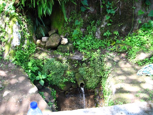
Vincent Uhl assisted students in the villages of Kop and Gundom in the Northwest Province in the evaluation of spring sources that are now being used for a permanent piped water supply system. Springs were identified, their flows measured, and water quality samples were collected and analyzed. Two springs were selected in each village for development. Piping systems were mapped in the field and planning proceeded for the coordination of system installation on a subsequent trip.
BACK TO TOP |
|
| ETHIOPIA |
CLIENT: |
Stantec (Formerly MWH) and USAID |
|
PROJECT: |
USAID A&E IQC -- Water Knowledge Management |
|
LOCATION: |
Ethiopia (2013 to 2016) |
|
Uhl & MWH formulated an Opportunities and Limitations for Small-Scale Irrigation Using Shallow Groundwater Projects to support the goals of the Government of Ethiopia to move 6 million households into food security and improve livelihoods of small farmers through small-scale irrigation using shallow groundwater.
The objectives of this project were to develop:
- An awareness of the opportunities and limitations for small-scale irrigation using shallow groundwater, and
- The need for planning and management on a watershed basis so that the groundwater resource is developed sustainably.
In this context, UHL developed the “Irrigable Land Potential (ILAP) Calculator” as a technical planning tool to assess available quantities of shallow groundwater for small-scale irrigation and develop realistic estimates of the potential land area within a watershed that can be sustainably irrigated. The calculator quantifies the available groundwater based on a percentage of precipitation, reserving a percentage for natural resource (environmental) flows, and accounting for current and future groundwater use in the basin.
The ILAP Calculator was applied to two Pilot Basins (watersheds), the Gerbi and Tefki Area with some illuminating results demonstrating the value of the ILAP tool.
As a precursor to applying the ILAP Calculator, several studies were carried out to gain an understanding of the conditions in and available data for each basin.
These studies included:
- The development of mapping products utilizing Digital Elevation Models (DEMs) and satellite imagery (Landsat 8 platform). DEMs were used for generating watershed boundaries, slope maps, and ground topographic contours. Satellite images were used for understanding the land use/land cover patterns. A precipitation map was generated by interpolating data from nearby weather stations with records available from the past two decades.
- A Field Reconnaissance, which involved:
(a) An inventory of a subset of representative water points;
(b) Field water-quality of testing of delivered water from the water points with functional water systems; and
(c) Short-term pumping tests on selected hand-dug open wells.
BACK TO TOP |
|
CLIENT: |
ATA and Aquacon Ethiopia |
|
PROJECT: |
Small Scale Irrigation Planning |
|
LOCATION: |
Ethiopia – Various Regions |
|
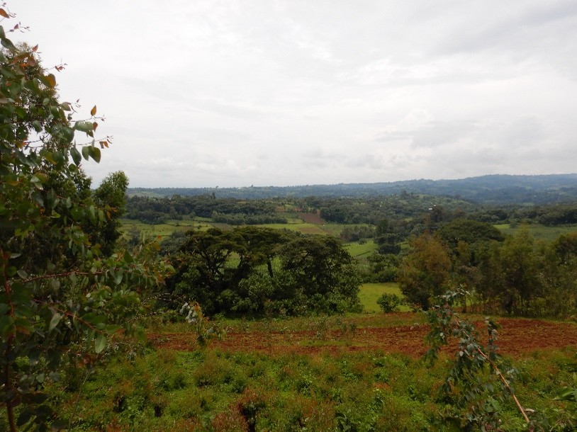
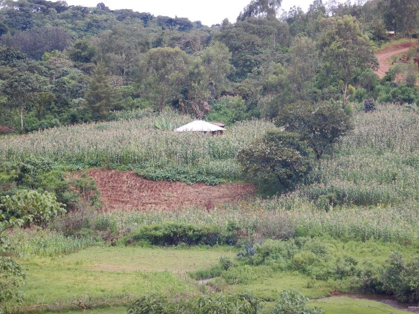
The Government of Ethiopia Agricultural Transformation Agency (ATA) has been leading an initiative to increase small farmer irrigation in Ethiopia using shallow groundwater sources. Over the past several years, ATA has been mapping shallow groundwater availability and sustainability. UHL & Associates assisted ATA in the evaluation of applicable shallow well and borehole drilling techniques and in the area of low lift pumping technologies including manual and solar powered pumping systems.
UHL assisted ATA with identifying regoliths in areas west of Addis Abeba. Satellite remote sensing techniques were used to identify regoliths over a project area covering ~60,000 sq.km. The purpose the study was to target areas of shallow groundwater availability for small scale irrigation.
End of project workshops were conducted by the project team for the ATA and regional staff participation.
BACK TO TOP |
|
| LIBERIA |
CLIENT: |
World Bank Liberia Water Sanitation Program (WSP) & Liberia Department of Public Works |
|
PROJECT: |
Urban and Semi- Urban Water Point Sampling Project |
|
LOCATION: |
Monrovia, Liberia |
|
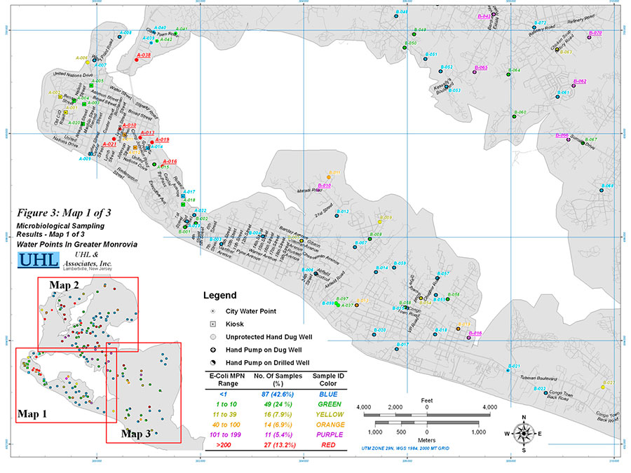
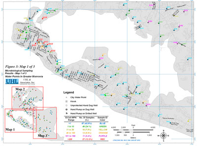
UHL & Associates in association with the University of the Free State, South Africa and EDEN Preferred Water Services of Monrovia, Liberia sampled 202 water points in the capital city of Monrovia. The collected samples were analyzed for:
- Field parameters (collected at water point): Electrical Conductivity (EC), pH, Temperature (T), Oxidation Reduction Potential (ORP), and Dissolved Oxygen (DO).
- Microbiological Parameters (analyzed in field laboratory in Monrovia): Heterotrophic plate counts (HPC), Total Coliform, and E-Coli.
- Inorganic and Organic Chemical Parameters (analyzed at the
University of Free State analytical laboratories in Bloemfontein, South Africa): Anions [Cl, SO4, NO3, F, B, PO4]; Cations [Ca, Mg, Na, K]; Metals [Al, As, Cr, Cu, Fe, Mn, Pb, Zn]; and TOC.
Principal Activities:
- Identifying a subset of 200 water points from a dataset of 1000+ water points to represent the range of source types including hand-dug wells (protected and not protected), drilled wells, city supplied standpipes and kiosks.
- Developing recommendations for short, mid and long-term water quality improvement.
- Organizing workshops to educate involved government agencies and interested non-government agencies.
- Sampling the 200 water points and training locals on relevant sampling procedures, quality control.
- Preparing maps showing Total Coliform and E-Coli contamination, and Inorganic and Organic chemical parameters.
Download PDF of the Case Study
BACK TO TOP |
|
| MALAWI |
CLIENT: |
University of Delaware – Engineers Without Borders (EWB) |
|
PROJECT: |
Malawi - Zomba Region – Village Water Suppliesn |
|
LOCATION: |
Sakata District, Malawi (2017 to 2022) |
|
Vincent Uhl mentored engineering students from the University of Delaware during two assessment phase evaluations of potential source locations for village water supply systems. Mr. Uhl assisted students in several villages in Sakata District, Zomba Region of Malawi.
In the assessment phase, existing hand dug, and drilled wells/boreholes were surveyed, and water quality samples collected and analyzed. Ground geophysical surveys were conducted to prioritize drilling locations for village supply boreholes. Planning proceeded for the coordination of water supply boreholes and hand-pump system installations which were accomplished on subsequent trips. Community engagement was critical and water user associations (WUAs) were developed during the assessment phases and subsequently involved in the project planning and implementation. New borehole drilling programs were conducted in 2018 and borehole repair and rehabilitation programs in 2021.
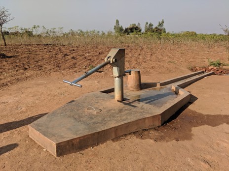
Photo: Hand Pump Installation at Chillamani Village, Malawi
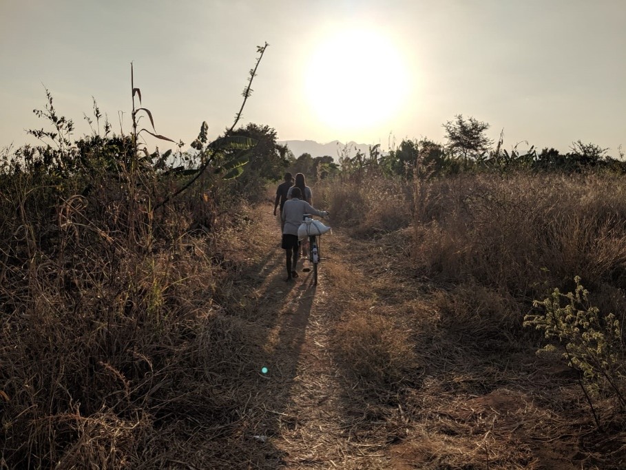
Photo: Footpath to Hand Dug Well in Chillamani Village
BACK TO TOP |
|
| NIGER |
CLIENT: |
USAID and Winrock |
|
PROJECT: |
RISE II -- Niger & Burkina Faso |
|
LOCATION: |
Niger and Burkina Faso |
|
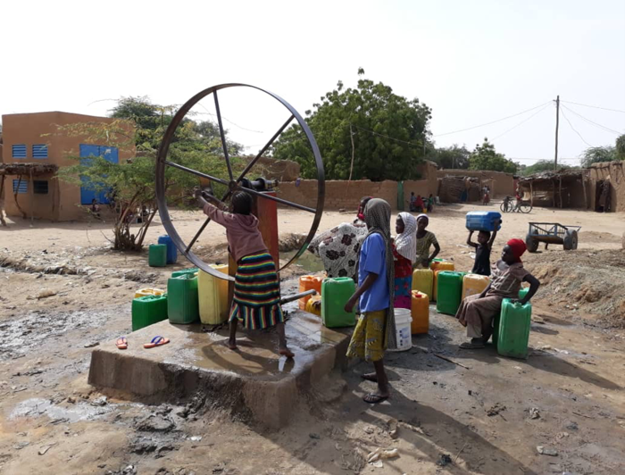
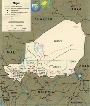
UHL & Associates assisted Winrock International to provide technical assistance in groundwater resources assessment, sustainability evaluations, and capacity building. UHL developed working relationships with Maradi and Zinder Universities Geology Departments for Commune Level water point inventories, assessments, and hydrogeologic analysis.
Some of the principal areas of focus have been:
- Field survey planning and coordination.
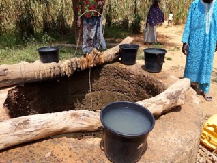
- Communal-level water point assessments with water-quality sampling and field/laboratory analysis; water-point physical condition analysis; and needed repairs/replacements.
- Regional and commune-level mapping of principal aquifer and surface drainage systems.
- Commune-level groundwater balance development and sustainability analysis for present and future water-supply planning.
- The initiation of groundwater level measurement programs at the commune level for tracking water levels seasonally by commune members.
BACK TO TOP |
|
CLIENT: |
Millenium Challenge Corporation (MCC) and Stantec |
|
PROJECT: |
MCC Niger |
|
LOCATION: |
Tillaberi; Dosso; Tahoua; and Maradi Regions (2018 - 2025) |
|
UHL & Associates has been providing technical input to Millennium Challenge Corporation (MCC) & the Millennium Challenge Account (MCA) is the areas of:
- Groundwater resource development feasibility.
- Groundwater sustainability and an overview of the principal aquifers in the four project regions.
- Irrigation feasibility and constraints in semi-arid settings.
- Livestock Markets water systems design and costing assessments.
- Site visits and training of MCA staff.
- Base maps, and drainage maps preparation for project analyses
BACK TO TOP |
|
| SENEGAL |
CLIENT: |
NRCE and USAID |
|
PROJECT: |
Groundwater Recharge Analysis for Senegal: USAID Access Project Under the WADI IQC |
|
LOCATION: |
Senegal (2016 to 2018) |
|
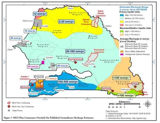
Recharge to groundwater can be estimated from field-based, analytical, and numerical methods. UHL conducted an analysis which identified and summarized the findings of both local and global precipitation and groundwater recharge studies for areas in Senegal. Using estimates from the various studies and experience in similar climatic and geologic environments, average annual groundwater recharge estimates were developed for communes in six regions. Conservative groundwater recharge values were recommended for use in groundwater planning, allowing a reserve for ecological water needs.
The local and regional studies included the following methodologies:
- The Chloride Mass Balance (CMB) approach.
- The Water-Table Fluctuation (WTF) method.
- Thornthwaite-Mather Water Balance (TMWB), a water-balance spreadsheet approach that considers monthly precipitation, evapotranspiration, soil moisture, etc.
- Numerical modeling methods.
- Application of the WHYMAP model global data set developed by Döll, P. & Fiedler, K. 2008. Global-scale modelling of groundwater recharge. Hydrology and Earth System Sciences, 12, 863-885.
- Applying percentages of precipitation as recharge based on studies in similar hydrogeologic and climate settings.
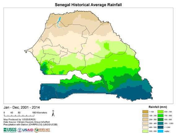
Data for the period from 1981-2010 indicates an increase in precipitation from south-to-north. The range is from >1000 mm/yr in the south to <200 mm/yr in the north which reflect very dry conditions with commensurate limits on groundwater recharge.
BACK TO TOP |
|
| SOMALILAND |
CLIENT: |
Hargeisa Water
Authority
|
|
PROJECT: |
Assessment of City of
Hargeisa Wellfield
|
|
LOCATION: |
Hargeisa, Somaliland
|
|
 The Hargeisa Water Authority has an exceptionally challenging mission to keep the water supply flowing into Hargeisa, the largest population center and seat of government in Somaliland. This hillside metropolis of over 300,000 people obtains its water from a wellfield located in the Ged Dheeble valley about 20 kilometers distant from the city. The Hargeisa Water Authority has an exceptionally challenging mission to keep the water supply flowing into Hargeisa, the largest population center and seat of government in Somaliland. This hillside metropolis of over 300,000 people obtains its water from a wellfield located in the Ged Dheeble valley about 20 kilometers distant from the city.
UHL was contracted by WorldWater Corporation to evaluate the wellfield, and the distribution system from the wellfield to the City. The City's water supply system was installed by the Chinese Government in the early 1970's and expanded in 1986-88. The system was designed to deliver 8,000 to 10,000 m3/day (2 to 2.5 million gallons per day). Water extracted from twelve production boreholes is pumped through two twin underground 300 mm diameter pipelines over a 20 km distance and 260 m elevation to in-ground storage tanks overlooking the city.
Due to damage to the system during civil war in the late 1980's, only six production boreholes were operative at the time of the study. Our evaluation involved an analysis and testing of the six production boreholes; an assessment of requirements to reactivate the 6 boreholes that had been in operation for over a decade, and the outline of a program for additional groundwater exploration in nearby basins. We also outlined the elements of a program to evaluate recharge to the aquifer system supplying the city, and initiated a water-level and water-quality monitoring program for the water utility.
BACK TO TOP |
|
| VARIOUS COUNTRIES |
CLIENT: |
World Bank Group |
|
PROJECT: |
Sahel Groundwater Initiative – Small Farmer Irrigation |
|
LOCATION: |
Sahel – Burkina Faso, Chad, Mali, Mauritania, Niger, and Senegal (2021 to 2022) |
|
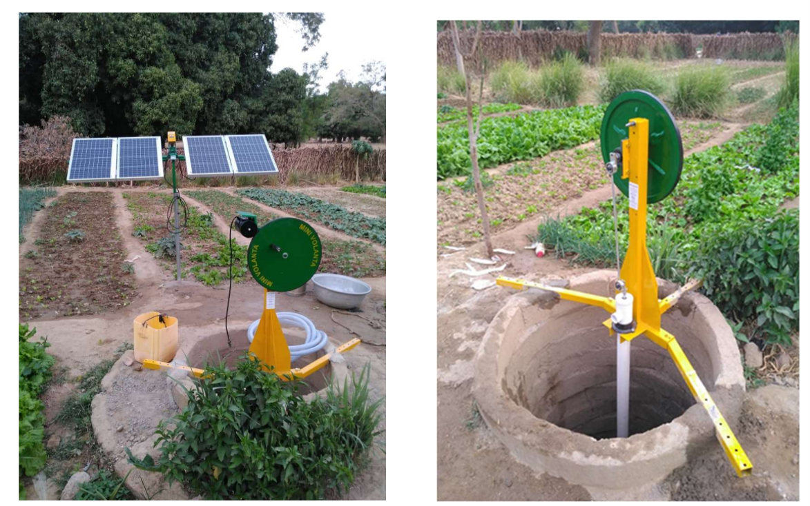
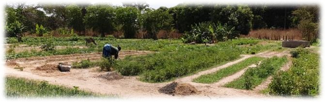
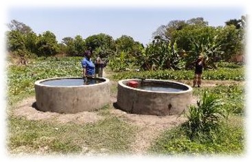
Shallow groundwater-based irrigation potential for small-scale farming exists in the alluvial valleys/plains of major perennial rivers (e.g., Niger, Gambia, Senegal, Volta River systems, and tributaries to Lake Chad including the Shari and Lagone Rivers) and seasonal drainages (wadis/dallols), where aquifer conditions are compatible with the application of low-cost drilling and pumping techniques. These generally correspond to areas where the water table is shallow, the aquifer systems are comprised of unconsolidated alluvium, and where higher focused groundwater recharge is observed as a consequence of rainfall runoff to perennial rivers or seasonal surface water drainages.
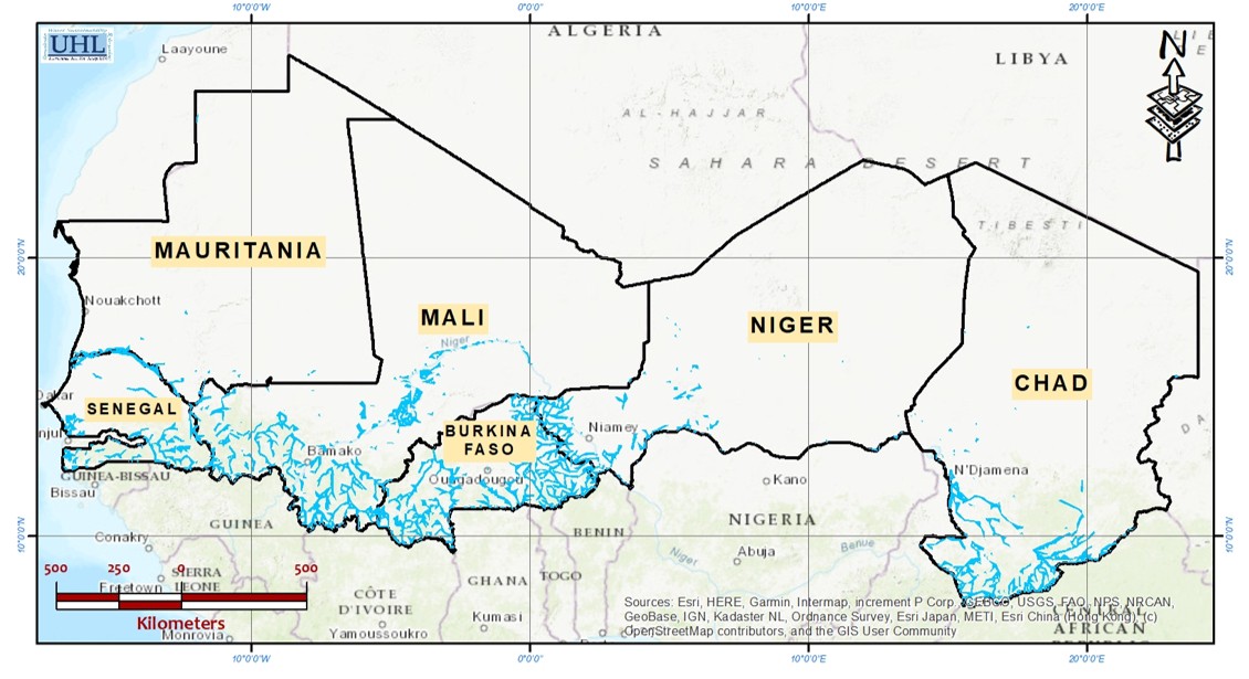
Figure 1: Mapped Areas of the Project Countries with Estimated Depth to Groundwater from 0-7 m, bgl (shallow groundwater data from BGS, 2019 )
Significant shallow groundwater potential also exists in: (1) the weathered/ saprolite/laterite zones of basement and metasedimentary rock aquifers which are fairly extensive in southeast Senegal, southern Mali, Burkina Faso, and southwest Niger (Figure 2), and (2) in the shallow unconsolidated sedimentary aquifers (Ziguinchor and Sedhiou Regions in Senegal, and central and southern Chad).
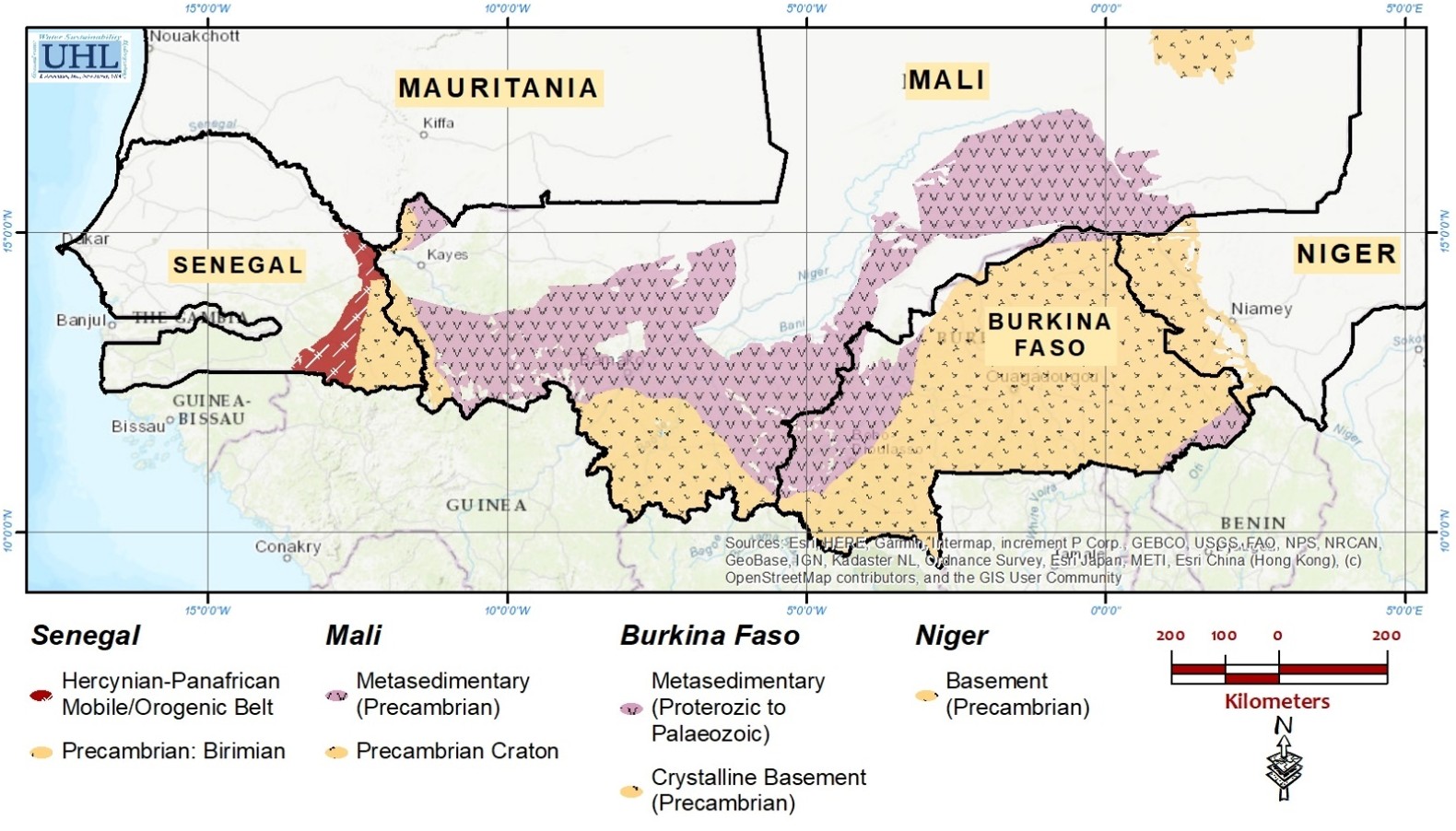
Figure 2: Basement and Metasedimentary Rock Aquifer Areas in
Burkina Faso, Mali, Niger, and Senegal
BACK TO TOP |
|
|

 Vince Uhl: +1 (609) 947-1703